Sourced from Gothamist | Feb 16, 2023
A program that tracks flooding across the city in real time is allowing more New Yorkers to see water depths and flood risks as rain pours down.
FloodNet, a collaborative project begun in Autumn 2020 by NYC colleges, consists of 31 sensors deployed in areas that are prone to severe floods, such as the Gowanus Canal.
A recent city grant of $7.2 million will increase its network of citywide sensors to more than 500 over the next five years, starting in February with its Staten Island installations.
They are striving to make data easy and accessible as possible to the average New Yorker, meaning they can access and easily understand what the data means.
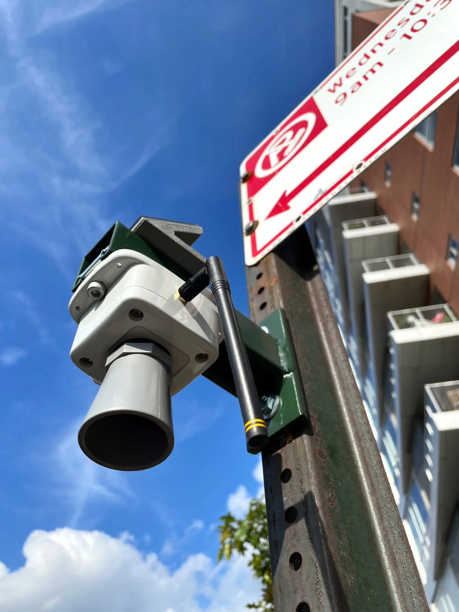
The sensors attach to a sign post that is about 10 feet up, and work by sending an ultrasonic pulse to the ground. These sound waves bounce off whatever surfaces are below and then travel back up to the sensor, measuring how much water is on the ground. These energy efficient units are also solar powered and transmit data wirelessly.
FloodNet's dashboard launched a year after Hurricane Ida, and displays all the data collected by its open source sensors, allowing residents to monitor and respond to a flood as it happens. Residents can also see the recorded depths and receive alerts.
This data gathering contributes and helps the growing community engagement that is part of the project's scientific work. Researchers can interact with residents on how to improve the project, and local stakeholders request sensors for certain spots while also offering suggestions to make the data more user friendly.
“We’re striving to make data as accessible to the average New Yorker as possible, meaning that they can access and understand the data.
That can be useful for them in terms of responding to a flooding event in real time as it happens.”

Brett Branco stands with a FloodNet sensor in Fort Hamilton.
FloodNet began as a collaboration between Branco and Silverman. They installed their first sensor back in October 2020 on the corner of Hoyt and Fifth streets in Gowanus, Brooklyn.
The data could help city agencies prioritize where infrastructure money needs to be well spent to fix the flooding problem. Weather models and forecasting tools help identify future flooding that can be checked for accuracy against the FloodNet dataset and improve precision.
As the FloodNet team expands its network citywide, it also hopes to collect more information beyond the basic depth of water on a street. Silverman wants to know more about the flooding rates at a storm's onset, local drainage rates, and the duration of an event.
If there's a flood developing, looking at one of these real time data sets can help understand how we issue the right warnings to people in advance, or if we need to issue other warnings now.